SIPAM EN
The abbreviation SIPAM means, in Polish, the Spatial Information System of the Maritime Administration. You will find there data concerning:
Vector data
- Zones closed to shipping and fishing (restricted_zone).
- Zones dangerous to shipping and fishing (restricted_zone).
- Traffic separation schemes (traffic_route).
- Traffic routes (traffic_route).
- Boundaries of the marine internal waters (coastline).
- Boundaries of the territorial sea (territorial_sea_border, territorial_sea ).
- Boundaries of the exclusive economic zone (eez_border, eez).
- Boundaries of the marine contiguous zone (contiguous_zone_border, contiguous_zone).
- Safety zones around artificial islands, installations and structures established by the maritime office (constuction_safety_zone).
- Location permits for artificial islands, installations and structures (investment_permit).
- Location permits for cables and pipelines (cable_pipeline_permit).
- Wrecks (wreck).
- Boundaries of the coastal strip (technical strip and protection strip) (coastal_zone_border_tech, coastal_zone_border_ochr) .
- Territorial jurisdiction of the maritime offices (maritime_office_border, maritime_office_zone).
- Port borders and their roadsteads (port, roadstead).
- Borders of marinas and anchorages (marina, sea_area).
- Port and marina access infrastructure (sea_area, hydrotechnical_infrastructure).
- Approach tracks (traffic_route).
- Kilometers of the sea coast (coastal_milage).
- Numbering of beach entrances (coast_entry).
- Natura 2000 nature protection plans in marine areas (n2000_conservation_plan_oso, n2000_conservation_plan_soo).
- Coastline (coastline).
- Baseline of the territorial sea (baseline).
- Protection limit line (protection_limit_line).
- Sections of the shore covered by the sea shore protection program (pobm).
- Permit to use the areas located within the technical belt for purposes other than maintaining the shore in a condition consistent with the requirements of safety and environmental protection (coastal_zone_use_permission).
- Permit to be exempted from the prohibitions set out in Article 88 l of the Water Law (in the version in force until the end of 2017) (flood_risk_use_permission).
- Property use agreements (property_rent_agreement).
- Decisions on permanent management (marine waters) (property_admin_right).
- Decisions on permanent management (land) (property_admin_right).
- Forest management plans of the Maritime Offices (forestry_plans_ciek_lin, forestry_plans_kom_lin, forestry_plans_obch_lin, forestry_plans_obw_pol, forestry_plans_oddz_pol, forestry_plans_pnsw_pol, forestry_plans_uzbr_lin, forestry_plans_wydz_pol, forestry_plans_zreb_pol).
Raster data
- Bathymetric data (bathymetric_survey).
- LIDAR data (lidar_survey).
- Orthophotomaps (imagery_survey).
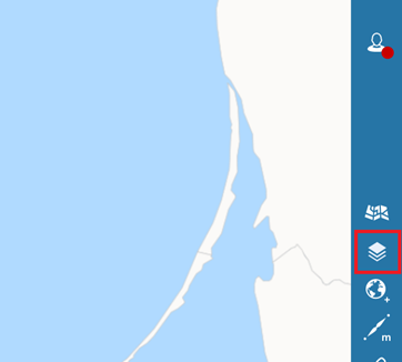
Geoportal SIPAM
https://sipam.gov.pl/geoportal
Access to the data
WMS:
https://ogc.sipam.gov.pl/geoserver/SIPAM/wms
WMS with part of the data translated into English:
https://ogc.sipam.gov.pl/geoserver/SIPAM_ENG/wms
WFS:
https://ogc.sipam.gov.pl/geoserver/SIPAM/wfs
WFS with part of the data translated into English:
https://ogc.sipam.gov.pl/geoserver/SIPAM_ENG/wfs
A copy of these vector data can be downloaded in the following formats:
Geography Markup Language (GML)
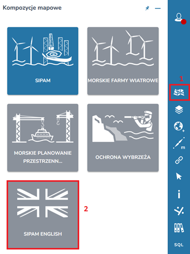
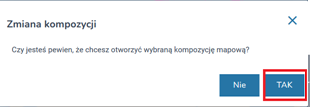
We have also prepared a map composition with some data in English. To open it:
1. https://sipam.gov.pl/geoportal
2. Click:
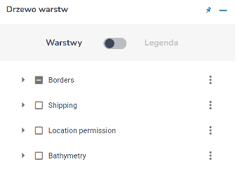
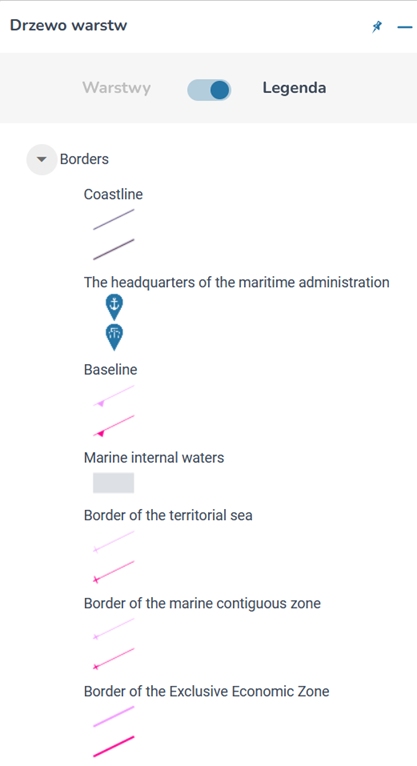
3. In order to see the layers (in Polish: “Warstwy”) and legend (“Legenda”):