MSP
Maritime spatial plans for the Polish sea areas are prepared by the directors of maritime offices for the areas of the exclusive economic zone, the territorial sea and the internal marine waters. Draft plans are prepared in accordance with the requirements of the Act on the maritime areas of the Republic of Poland and the maritime administration.
For draft plans, a Strategic Environmental Assessment is prepared in accordance with the requirements of the Act on the provision of information on the environment and its protection, public participation in environmental protection and on environmental impact assessments. The draft plan together with the SEA is subject to public consultations.
Maritime spatial plans for the Polish sea areas are adopted by way of a Regulation of the Council of Ministers.
Maritime spatial plan for Polish sea areas on a scale of 1: 200,000
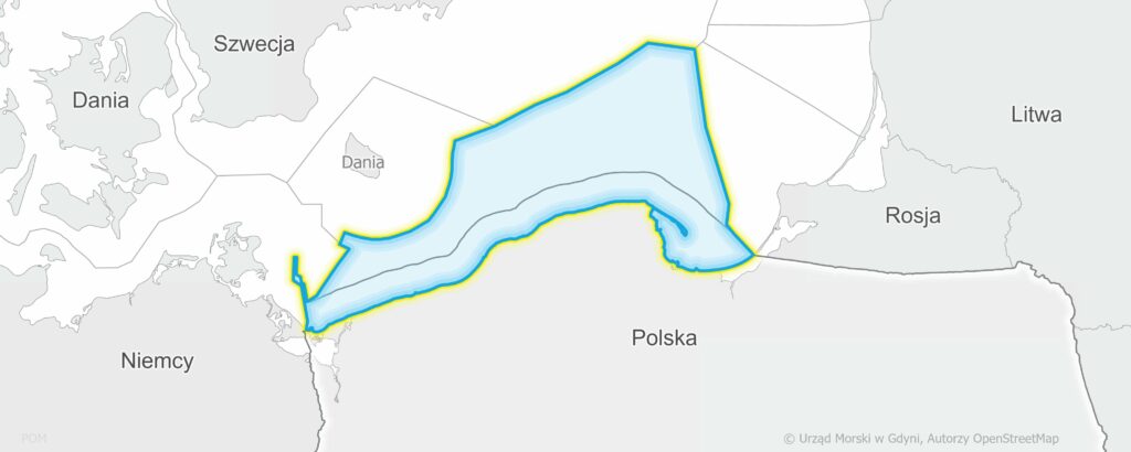
Maritime spatial plan for the internal marine waters, the territorial sea and the exclusive economic zone on a scale of 1: 200,000 was adopted by the Regulation of the Council of Ministers of April 14, 2021 (Journal of Laws of 2021, item 935). The regulation entered into force on May 22, 2021.
On December 8, 2022, the regulation of the Council of Ministers of November 9, 2022 came into force amending the regulation on the adoption of the maritime spatial plan for the internal marine waters, the territorial sea and the exclusive economic zone on a scale of 1:200,000 (Journal of Laws of 2022, item 2518).
The ordinance amended the POM.01.Ip, POM.02.C and POM.08.P basin cards in the scope of concession no. 9/2017/Ł for the exploration and appraisal of crude oil and natural gas deposits and the production of crude oil and natural gas from deposits, and a number of minor legislative changes were introduced.
Other adopted maritime spatial plans
Rozporządzenie Rady Ministrów z dnia 12 lipca 2024 r. w sprawie przyjęcia planu zagospodarowania przestrzennego morskich wód wewnętrznych – port morski w Darłowie (Dz.U. z 2024 r. poz. 1173)
Rozporządzenie Rady Ministrów z dnia 20 grudnia 2024 r. w sprawie przyjęcia planu zagospodarowania przestrzennego morskich wód wewnętrznych – port morski w Dziwnowie (Dz.U. z 2025 r. poz. 54)
Rozporządzenie Rady Ministrów z dnia 31 października 2023 r. w sprawie przyjęcia planu zagospodarowania przestrzennego morskich wód wewnętrznych – port morski w Dźwirzynie (Dz.U. z 2023 r. poz. 2516)
Rozporządzenie Rady Ministrów z dnia 26 września 2024 r. w sprawie przyjęcia planu zagospodarowania przestrzennego morskich wód wewnętrznych – port morski w Elblągu (Dz.U. z 2024 r. poz. 1594)
Rozporządzenie Rady Ministrów z dnia 30 sierpnia 2023 r. w sprawie przyjęcia planu zagospodarowania przestrzennego morskich wód wewnętrznych – port morski w Kołobrzegu (Dz.U. z 2023 r. poz. 2173)
Rozporządzenie Rady Ministrów z dnia 4 sierpnia 2025 r. w sprawie przyjęcia planu zagospodarowania przestrzennego morskich wód wewnętrznych – port morski w Łebie (Dz.U. z 2025 poz. 1121)
Rozporządzenie Rady Ministrów z dnia 31 lipca 2023 r. w sprawie przyjęcia planu zagospodarowania przestrzennego morskich wód wewnętrznych – port morski w Mrzeżynie (Dz.U. z 2023 r. poz. 1727)
Rozporządzenie Rady Ministrów z dnia 7 listopada 2024 r. w sprawie przyjęcia planu zagospodarowania przestrzennego morskich wód wewnętrznych – port morski w Policach (Dz.U. z 2024 r. poz. 1800)
Rozporządzenie Rady Ministrów z dnia 14 lipca 2025 r. w sprawie przyjęcia planu zagospodarowania przestrzennego morskich wód wewnętrznych – port morski w Rowach (Dz.U. z 2025 r. poz. 1061)
Rozporządzenie Rady Ministrów z dnia 16 sierpnia 2024 r. w sprawie przyjęcia planu zagospodarowania przestrzennego dla części morza terytorialnego oraz morskich wód wewnętrznych – port morski w Świnoujściu (Dz.U. z 2024 r. poz. 1337)
Rozporządzenie Rady Ministrów z dnia 31 maja 2024 r. w sprawie przyjęcia planu zagospodarowania przestrzennego morskich wód wewnętrznych – port morski w Szczecinie (Dz.U. z 2024 r. poz. 1014)
Rozporządzenie Rady Ministrów z dnia 31 maja 2024 r. w sprawie przyjęcia planu zagospodarowania przestrzennego morskich wód wewnętrznych – port morski w Trzebieży (Dz.U. z 2024 r. poz. 931)
Rozporządzenie Rady Ministrów z dnia 6 grudnia 2024 r. w sprawie przyjęcia planu zagospodarowania przestrzennego morskich wód wewnętrznych – port morski w Ustce (Dz.U. z 2025 r. poz. 57)
Rozporządzenie Rady Ministrów z dnia 30 kwietnia 2025 r. w sprawie przyjęcia planu zagospodarowania przestrzennego morskich wód wewnętrznych Zalewu Kamieńskiego (Dz.U. z 2025 r. poz. 675)
Rozporządzenie Rady Ministrów z dnia 21 listopada 2023 r. w sprawie przyjęcia planu zagospodarowania przestrzennego morskich wód wewnętrznych Zalewu Szczecińskiego (Dz.U. z 2023 r. poz. 2621)
Rozporządzenie Rady Ministrów z dnia 6 grudnia 2024 r. w sprawie przyjęcia planu zagospodarowania przestrzennego morskich wód wewnętrznych Zalewu Wiślanego (Dz.U. z 2025 r. poz. 145)
GIS data from the adopted plans are available as WMS (view) and WFS (download) services:
- https://ogc.sipam.gov.pl/geoserver/SIPAM/wms
- https://ogc.sipam.gov.pl/geoserver/SIPAM/wfs
WMS and WFS layers:
Maritime spatial plan for Polish sea areas on a scale of 1: 200,000: Akweny POM, Akweny POM – wariant b, Podakweny POM, Podakweny POM – wariant b
Other adopted maritime spatial plans: Akweny, Akweny – wariant b, Podakweny, Podakweny – wariant b
Each plan has its own plan code included in full_name attribute, e.g. ELB.01.T, LEB.01.T
Plan codes
| Code | Name of the plan | Responsible authority |
| DAR | port morski w Darłowie | Maritime Office in Szczecin |
| DZI | port morski w Dziwnowie | Maritime Office in Szczecin |
| DZW | port morski w Dźwirzynie | Maritime Office in Szczecin |
| ELB | port morski w Elblągu | Maritime Office in Gdynia |
| GDA | port morski w Gdańsku | Maritime Office in Gdynia |
| GDY | port morski w Gdyni | Maritime Office in Gdynia |
| HEL | port morski w Helu | Maritime Office in Gdynia |
| KOL | port morski w Kołobrzegu | Maritime Office in Szczecin |
| LEB | port morski w Łebie | Maritime Office in Gdynia |
| LJW | wody przyległe do brzegu morskiego na odcinku od Władysławowa do Łeby | Maritime Office in Gdynia |
| MRZ | port morski w Mrzeżynie | Maritime Office in Szczecin |
| POL | port morski w Policach | Maritime Office in Szczecin |
| POM | Plan zagospodarowania przestrzennego polskich obszarów morskich w skali 1: 200 000 | Maritime Office in Gdynia, Maritime Office in Szczecin |
| ROW | port morski w Rowach | Maritime Office in Gdynia |
| SWI | port morski w Świnoujściu | Maritime Office in Szczecin |
| SZC | port morski w Szczecinie | Maritime Office in Szczecin |
| TRZ | port morski w Trzebieży | Urząd Morski w Szczecinie |
| UST | port morski w Ustce | Maritime Office in Gdynia |
| WLA | port morski we Władysławowie | Maritime Office in Gdynia |
| ZGD | Zatoka Gdańska | Maritime Office in Gdynia |
| ZKA | Zalew Kamieński | Maritime Office in Szczecin |
| ZSZ | Zalew Szczeciński | Maritime Office in Szczecin |
| ZWI | Zalew Wiślany | Maritime Office in Gdynia |